Chemung River at Chemung, NY
Overview
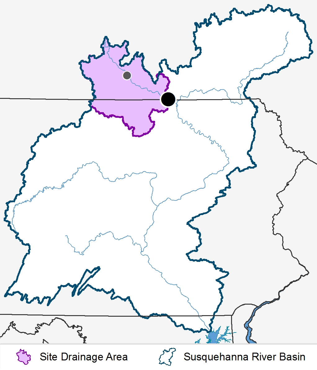
- Station Id: 01531000
- County: Chemung
- Drainage Area: 2,507 sq.mi.
- Station Coordinates: 42.003°, -76.635°
- Period of record: 10/04 to present
- Elevation: 779 ft.
Location Description
Station is located on the bridge 0.76 miles southwest of Chemung on Route 3.
Data
- Data File Description
- CHE.xlsx October 2004 to present
2021 Land Use
| Urban | Agricultural | Agricultural | Forested | Other | ||
|---|---|---|---|---|---|---|
| Row Crops | Pasture/Hay | Total | ||||
| 8% | 5% | 24% | 29% | 60% | 3% | |
Site Drainage Area
Please select a parameter from the list to view graphs of loads and concentrations. You may need to scroll down to view graphs.
Loads
Concentrations
Data
2024 Flow Normalized Trends
| Trend period (Water Year*) | 2005-2024 |
|---|---|
| Trend & Direction | NS – Not significant, UP – Increasing trend, DOWN – Decreasing trend |
| Hypothesis Test significance level (i.e. α) | 0.1 |
| * Water Year runs from October 1st to September 30th of the following year | |
| Likelihood Descriptor | Range of values** |
|---|---|
| HL (Highly Likely) | ≥0.95 and ≤1.00 |
| VL (Very Likely) | ≥0.90 and <0.95 |
| L (Likely) | ≥0.66 and <0.90 |
| ALAN (About as Likely as Not) | >0.33 and <0.66 |
| ** Values represent the posterior mean estimate of the probability of a trend | |
Chemung 2005-2024 |
Flow Normalized Concentration (mg/L) |
Flow Normalized Load (Millions Kg/yr) |
||||||
|---|---|---|---|---|---|---|---|---|
Likelihood Test |
Likelihood Test |
|||||||
| Parameter | Change | Value | Descriptor | Trend | Change | Value | Descriptor | Trend |
| Total Nitrogen | 0.0096744 | 0.5588235 | ALAN | NS | -0.1605711 | 0.8333333 | L | DWN |
| Nitrate-Nitrite | 0.0879733 | 0.7745098 | L | UP | 0.0815913 | 0.6176471 | ALAN | NS |
| Ammonia | -0.0074449 | 0.8333333 | L | DWN | -0.0403002 | 0.9313725 | VL | DWN |
| Dissolved Nitrogen | -0.0798608 | 0.8725490 | L | DWN | -0.2039621 | 0.8137255 | L | DWN |
| Nitrate-Nitrite | -0.0035700 | 0.5196078 | ALAN | NS | 0.0075825 | 0.5196078 | ALAN | NS |
| Ammonia | -0.0139218 | 0.8137255 | L | DWN | -0.0495999 | 0.9509804 | HL | DWN |
| Total Phosphorus | -0.0648003 | 0.9705882 | HL | DWN | -0.1137031 | 0.9705882 | HL | DWN |
| Particulate Phosphorus | -0.0168207 | 0.9705882 | HL | DWN | -0.0127432 | 0.6960784 | L | DWN |
| Dissolved Phosphorus | -0.0425613 | 0.9313725 | VL | DWN | -0.0772194 | 0.9705882 | HL | DWN |
| Orthophosphate | -0.0454154 | 0.9313725 | VL | DWN | -0.0795782 | 0.9705882 | HL | DWN |
| Total Organic Carbon | 0.2137209 | 0.8529412 | L | UP | 0.6695884 | 0.8333333 | L | UP |
| Total Suspended Solids | 0.5616132 | 0.5196078 | ALAN | NS | 95.1484581 | 0.7156863 | L | UP |
| Suspended Sediment | 9.4288358 | 0.7941176 | L | UP | 136.7403416 | 0.8921569 | L | UP |