Susquehanna Flood Warning & Response System
To provide flood inundation maps, estimated flood damages and impacts, and flood response actions to support risk-based decisions before, during and after flooding.
Flood Tool Access
The flood tool is accessible only for registered users. To request a login please visit SFWRS Contacts.
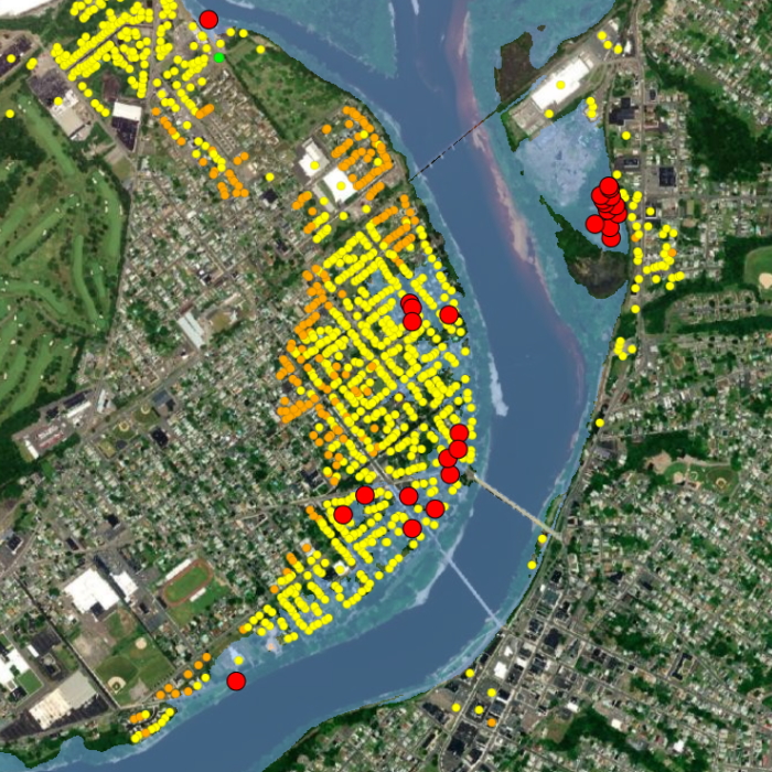 Example of the flood tool displaying inundation in West Pittston, PA
Overview
The Susquehanna Flood Warning and Response System (SFWRS) displays flood inundation maps tied to four river gauges. When using the SFWRS for a forecasted flood, the user can view the current hydrograph to determine the forecasted flood stage. Then the user can enter that flood stage into the tool to view the extent of flooding, calculate the expected damages for a certain area and view the necessary response actions.
SFWRS Contacts
Susquehanna River Basin Commission
4423 North Front Street
Harrisburg, PA 18110
(717) 238-0423
inundationmaps@srbc.gov
4423 North Front Street
Harrisburg, PA 18110
(717) 238-0423
inundationmaps@srbc.gov
Partners